Ove satelitske snimke najbolje pokazuju kakav pakao je u Kaliforniji zbog požara
Na području savezne države istovremeno gore drugi i treći najveći požari u povijesti

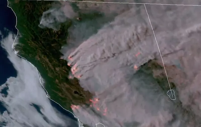
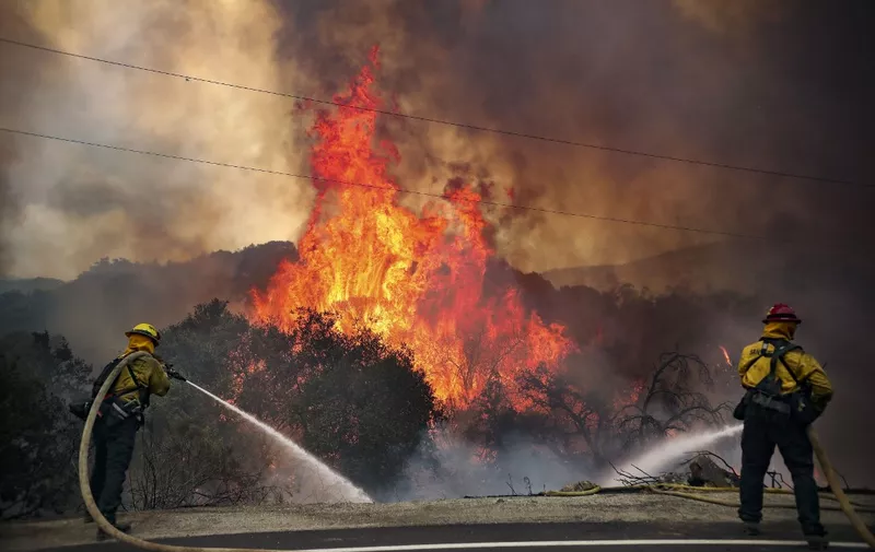
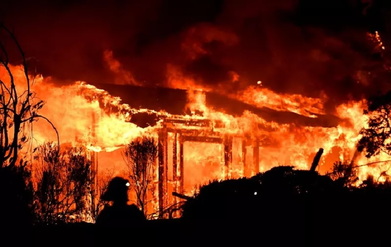
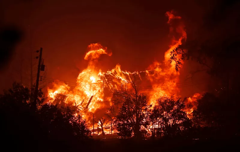
Golemi požari zahvatili su područje američke savezne države Kalifornije. Iako su požari tijekom ljeta tamo česta pojava, ove godine istovremeno gore drugi i treći najveći požar u povijestu, ali i još petstotinjak manjih odvojenih požara. Koliko su požari zastrašujući najbolje pokazuju satelitske snimke na kojima se jasno vidi kako je veća površina Kalifornije prekrivena dimom.
High resolution satellite imagery of wildfires burning last night in Northern California. pic.twitter.com/SodJKm9B1M
— CIRA (@CIRA_CSU) August 21, 2020
As the sun set yesterday, #GOESWest saw fires ignite and burn across the state of #California. The #CaliforniaWildfires recently intensified with the #LNUcomplexfire, which burned over 335 sq. miles in three days; currently, it is at 0% containment. pic.twitter.com/7Bh9aA9JSu
— NOAA Satellites (@NOAASatellites) August 21, 2020
Zbog klimatskih promjena deset najvećih požara u kalifornijskoj povijesti dogodilo se u posljednjih 17 godina, odnosno od 2003. godine. Tri najveća požara do sada, dogodila su se od 2018. godine do danas.
CA’s battling 2 of the largest fires in our history with 585 fires & 12,000 lightning strikes in the last week.
Thank you @realDonaldTrump for your partnership & granting this urgent declaration.
These are unprecedented times but CA’s resilient as hell. We’ll get through this. https://t.co/OvZjEOPS92
— Gavin Newsom (@GavinNewsom) August 23, 2020
Kvaliteta zraka je iznimno niska
Trenutno u Kaliforniji gori preko 900 kvadratnih kilometara, uglavnom južnije i sjevernije od zaljevskog područja San Francisca. Požari u Kaliforniji su u atmosferu ispustili rekordne razine ugljikovog dioksida, zbog čega je indeks kvalitete zraka na niskim razinama diljem savezne države.
If you don’t believe in climate change, come to California.
This is from today. And is just a small part of the nearly 600 fires we are battling this week. pic.twitter.com/iv4stV3Aax
— Gavin Newsom (@GavinNewsom) August 23, 2020
The 2nd & 3rd largest fires in California history are simultaneously burning, right now. pic.twitter.com/V7SdrOgckT
— Dakota Smith (@weatherdak) August 22, 2020
The smoke model posted by @NOAAResearch shows where the massive amounts of #smoke are expected to go in the next couple of days. @NOAA's #GOES17 satellite is showing where the #wildfire smoke is now, stretching from California to Texas. #CaliforniaWildfires #CAwx https://t.co/ymiSinLA8E pic.twitter.com/6CtnJ68iuP
— NOAA Satellites – Public Affairs (@NOAASatellitePA) August 20, 2020